

Strong storms are moving across the Midwest and could bring heavy rainfall with flooding and damaging winds exceeding 70 mph to areas of Iowa and Illinois tonight through Wednesday, the National Weather Service in Lincoln, Ill., reports.
Severe thunderstorms are likely across much of Eastern Iowa, Northwest Illinois, and Northeast Missouri tonight, as a warm front lifts north over the region. At this time, it appears the greatest threat for large hail, damaging winds, and a few tornadoes will be along and south of Interstate 80. Storms that form near the warm front will have the greatest chance of producing a tornado. Heavy rains of several inches will also be possible tonight and Wednesday, which may lead to some flash flooding as well as river flooding. Please continue to stay up to date on this changing weather with your favorite weather information source.

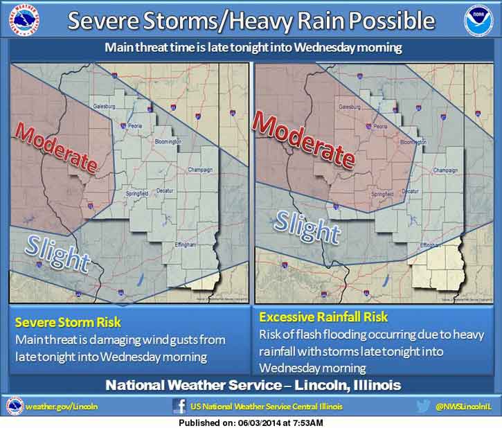
Strong storms are also possible Wednesday afternoon, especially across east-central Illinois, the National Weather Service said, as reported in the Bloomington Pantagraph.
In addition, the Associated Press is saying tornadoes are possible in five Midwestern states, including Iowa and Illinois.
“This is one of these days we can’t let our guard down,” the AP quoted Bill Bunting, who serves as forecast operations chief at the Storm Prediction Center in Norman, Okla., as saying. “It’s unfortunately panning out as we thought it would. This is shaping up as a very dangerous evening.”